Dolobran bridge
1.5km south-east of the village of Pontrobert, Montgomeryshire
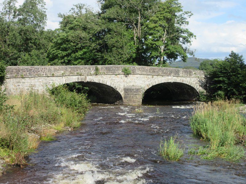
Dolobran bridge (referred to as ‘Pont y Ffatri’ on the OS 1:25,000 Explorer map 239) was built in 1838 to replace an earlier timber one. It carries the C road from the A495 south of Meifod in Montgomeryshire to Pontrobert over the River Vyrnwy. It consists of two low elliptical arches with prominent keystones and a pointed cutwater. The stonework of the arches is mostly rough-faced while that of the parapets is relatively smooth. It is possible that the parapets were later replaced. Building the bridge required adjustments to the road alignment and adversely affected the nearby weir, to the consternation of the owner of Mathrafal Farm which used water supplied by the mill race from the weir. The 1885 OS 6” map shows the relative positions of the road, river, mill-race and farm.
Text: David Ward